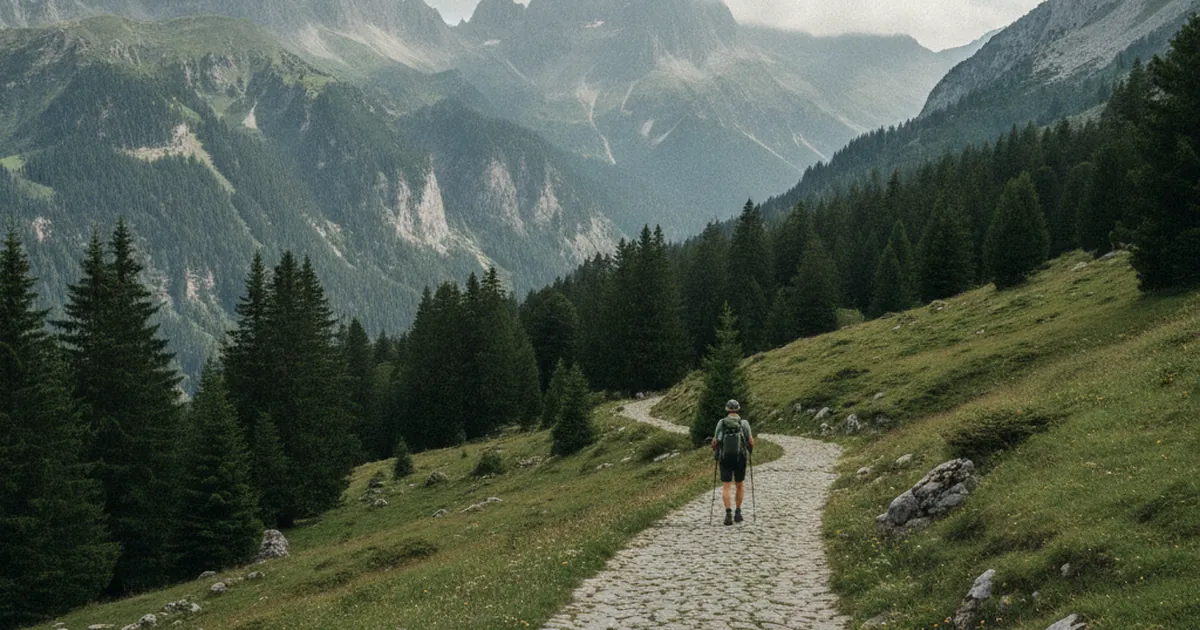
Long before tarmac roads, before horse-drawn carts could make it up the steep mountain slopes, goods moved through the Faucigny on the backs of mules. These paved paths, cut into vertiginous hillsides, formed a vital commercial network linking high mountain villages to the valley floors. Many of these ancient routes still exist today. You may walk them without realizing it, on a hiking trail that looks like any other, except that the stones are too regular, too deliberately placed, to be natural.
The Faucigny: a crossroads of alpine routes
The Faucigny is a historic region whose administrative heart lies in Bonneville. It stretches from the Arve valley in the south to the foothills of the Chablais in the north, encompassing the basins of the Giffre and the Borne rivers. This geographic position made it a natural crossroads between Dauphiné, Savoy, and the Geneva region. Merchants, soldiers, and pilgrims all had to pass through this territory, and mules were their indispensable travelling companions. The mule path network covered the entire region, from the most remote hamlets to the valley-floor markets. Through these tracks, the Faucigny was connected to the wider alpine world.
What the mules carried

Salt topped the list of transported goods. Essential for preserving food, it arrived from the salt works of Geneva or Salins-les-Bains along well-established routes. Muleteers, sometimes called arriériers in Savoy, organized convoys of several animals, each carrying around sixty kilos of cargo.
But salt was just the beginning. The mule paths also carried:
- cheese from the mountain pastures down to markets in Bonneville and La Roche-sur-Foron;
- woollen cloth and fabric from villages where sheep farming was practiced;
- timber, charcoal, and iron ore coming down from the heights;
- cereals, oil, and spices going the other way, up from the lowland markets.
The mule, sturdy and sure-footed, handled uneven terrain and steep slopes far better than a horse. On some stretches, loads were transferred to donkeys or simply carried by porters. The muleteer trade was an important economic activity for many families in the Faucigny, providing their main income for several months of the year.
How to spot a mule path
Several clues on the ground betray an old mule track.
The paving. Large flat stones laid flush, either tight-jointed or slightly spaced, are the most obvious sign. The width is typically between 1.2 and 1.8 metres, just enough for a laden mule to pass.
The consistency of the line. A mule path climbs in regular zigzags, never too steep (above 15 to 18 percent gradient, pack animals struggle). Bends are wide, calculated so that a loaded animal can turn without losing its balance. When you see a path that zigzags in a measured and regular way up a hillside, it is worth asking the question.
Milestones and drinking troughs. Placed every few kilometres, stone markers indicated directions and marked jurisdictional boundaries. Stone troughs, still visible in some spots, allowed animals to drink at mid-point along the journey.
Wear patterns. Centuries of hooves have carved grooves into the stones. On well-preserved sections, the channels worn by iron mule shoes are still clearly visible, parallel and regular, silent witnesses to thousands of passages.
Mule paths turned hiking trails
A large number of these ancient routes have been absorbed into the modern waymarked trail network. In the Faucigny, several hiking itineraries follow old mule paths, in whole or in part.
The ascent to the chapel of Jacquicourt from les Lanches, above the Mieussy area, follows sections of an old track that once connected isolated hamlets to the valley. Original paving still shows through the surface on several stretches, clearly visible where vegetation has not reclaimed it.
The Môle massif area, between Saint-Jeoire and Marignier, is especially rich in remains. This isolated peak, visible from across the Faucigny plain, was crossed by paths linking upper Faucigny villages to the lowland markets. The trail climbing from Saint-Jeoire partly follows these old routes, with paved sections still visible beneath the vegetation. It is a fine way to hike with a double perspective: the landscape, and the history beneath your feet.
Preservation and memory
These paths are fragile. Mechanized agriculture, urban development, and forestry works have caused many to disappear. Some stretches are listed in local heritage inventories, but without genuine legal protection. In the Aravis and Bornes area, volunteers are working to catalogue and maintain what remains, documenting surviving sections before they vanish.
The good news: where mule paths have been incorporated into the hiking network, they are maintained and walked regularly. That is the best way to keep them alive. Hiking them is also protecting them.
Generation after generation of muleteers crossed the Faucigny from end to end. Their paths shaped the landscape, carved into mountainsides, and connected communities that would otherwise have lived in isolation. Today, those routes are waiting for you as hiking trails. Look at the ground as you walk: the old stones still have stories to tell. To discover more itineraries across the Savoyard Pre-Alps, explore hiking trails in Haute-Savoie.