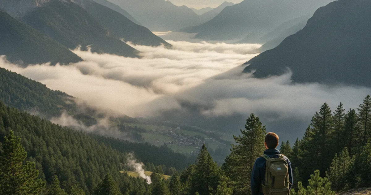
The Arve valley has a reputation for difficult weather: persistent cloud, low-hanging mist, grey skies even when the rest of Haute-Savoie is bathed in sunshine. That reputation is not entirely unfounded, but it tells only part of the story. By learning to read the valley's local weather patterns, you can often find windows that are far better than expected for hiking in Haute-Savoie.
A corridor exposed to westerly flows
The Arve valley stretches from the Pays du Mont-Blanc all the way to the outskirts of Geneva. Flanked to the north by the Faucigny ridges and to the south by the Aravis and Bornes massifs, it forms an east-west corridor that funnels moist air arriving from Lake Geneva and the Jura plateau directly up the valley floor. When that humid air hits the first mountain barriers, it rises and releases its precipitation.
This explains why rainfall totals in the Arve valley tend to be higher than in massifs with different orientations. The Giffre valley, which opens to the northeast, follows distinct patterns: it can be sunny when the Arve is socked in, or vice versa, depending on the prevailing airflow direction. Keeping this geography in mind is already a useful first filter when looking for a weather window.
Temperature inversions: when valley cloud is your ally
In spring and autumn, a recurring phenomenon shapes the valley's mornings: temperature inversion. On calm nights, cold dense air drains off the slopes and settles on the valley floor. Come morning, this trapped air warms slowly, staying locked beneath a layer of low cloud while the slopes above bask in full sunshine.
This is your best friend if you know how to spot it. A forecast of "overcast at low altitude" can hide a glorious day above 1,200 or 1,400 metres. Two tools make checking quick: webcams on nearby ski resorts (which show you the cloud ceiling in real time), and fine-scale models like Meteoblue or Météo60 that predict the cloud base altitude. If the cloud sea is visible from the ridgelines at 7 a.m., the day above it will often be excellent. This pattern is common between September and November, but can also occur in May and June after a calm night.
Morning windows in summer: getting ahead of convection
In summer the dynamics shift. Convective heating takes over: as the sun warms the ground, moist air rises and cumulus clouds build. These clouds swell through the morning and can produce thunderstorms by mid to late afternoon, sometimes developing in just a few minutes.
The ideal window falls between dawn and midday. Leaving before 7 a.m. lets you reach the high points comfortably, enjoy the summit in late morning, and begin your descent before the sky thickens. Plan to be off exposed ridges by 1:30 p.m. at the latest, and identify shelter options in advance along the route: dense forest, a refuge, a sheltered slope.
A hike that rewards an early alpine start from the Arve valley floor is Le Môle from La Tour. With 1,634 m of ascent starting from the valley floor, the route genuinely justifies rising before dawn to make full use of the stable morning window. The trailhead sits in La Tour, a well-placed base for gaining altitude quickly.
Foehn: a sudden ally
Foehn is a warm, dry wind that descends the northern slopes of the Alps after shedding its moisture on the southern side of the ranges. In the Arve valley it arrives as a dramatic clearance: the sky turns deep blue, visibility stretches to extraordinary distances, and the summits look deceptively close. These days are often among the most striking of the year for hiking.
But foehn has a capricious side. The shift from a foehn regime back to a northwesterly disturbance can happen in just a few hours. If anvil-shaped clouds start building to the north or northwest, even while the sky directly overhead is still clear blue, that is the signal to head down. A foehn window is never guaranteed to last the full day.
Practical forecasting tools
A few resources that make a real difference when reading Arve valley weather:
- Météo-France mountain bulletin (dial 3281): updated twice daily, it gives the rain-snow limit, high-altitude wind speed, and storm risk for each massif.
- Meteoblue and Météo60: high-resolution numerical models, useful for comparing 24-to-72-hour forecasts and checking the predicted cloud base altitude.
- Ski resort webcams: real-time visual confirmation of whether the temperature inversion has lifted before you set out.
- Windguru: for tracking wind by altitude layer, essential for spotting foehn episodes or storm-bearing airflows.
Never rely on a single source. Cross-checking two tools takes five minutes and can turn a wasted day into a rewarding outing above the clouds.
The weather in the Arve valley is more readable than it first appears. Temperature inversions, morning windows, foehn spells: each is an opening worth identifying before you lace up your boots. The key habit is straightforward: spend a few minutes the evening before cross-referencing sources and building a plan with a genuine safety margin, rather than relying on a quick glance at a general-purpose weather app.